Charting the Agricultural Land of South America
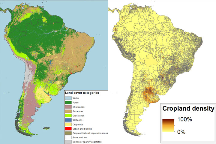
Navin Ramankutty contributed this article to the CGIAR Climate Change, Agriculture, and Food Security blog about how the EarthStat maps of cropland and pasture were created. It provides a high-level overview of agriculture and land use, a discussion of the methods used to create the maps, and his experiences teaching students about land use and global change.